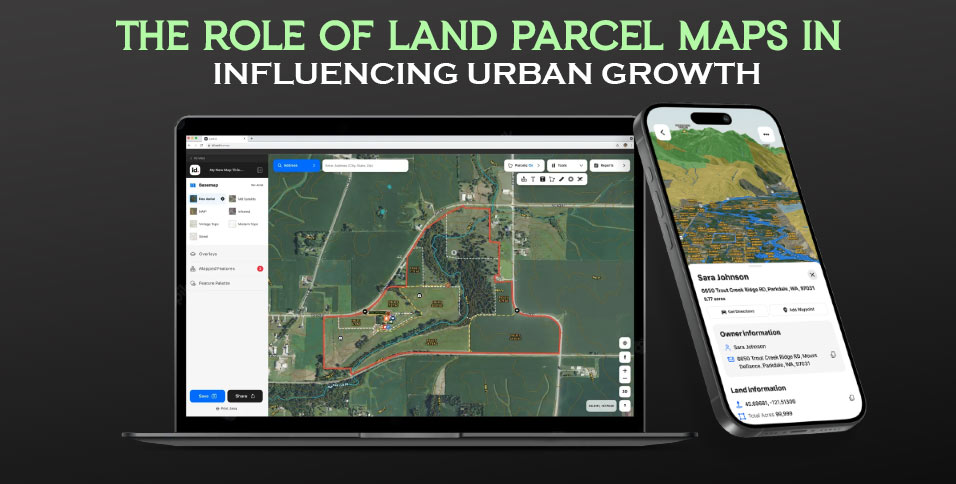
In the realm of growth, strategic planning plays a key role in fostering sustainable and orderly development. An essential instrument utilized by planners, policymakers, and real estate stakeholders is land parcel maps. These maps offer insights into land ownership boundaries, zoning regulations, and infrastructure details that are crucial for decision-making. This article delves into the influence of land parcel maps on expansion, examining their impact on decision-making processes, community involvement initiatives, and their potential to optimize resource allocation.
1. Improving Decision-Making Procedures
Land parcel maps play a significant role in guiding data-informed decisions within development endeavors. By presenting information on land uses through a land parcel app, these maps empower planners to make well-informed choices regarding infrastructure enhancements, residential developments, commercial area designation, and placement of public facilities. Through the analysis tools embedded in these maps that provide data insights, decision-makers can assess risks and opportunities objectively. This approach helps reduce risks associated with trial and error methods while enhancing resource utilization for progress.
2. Encouraging Communication and Engaging the Community
Effective communication among government bodies involved in planning and development projects is crucial for promoting inclusive decision-making processes. The use of land parcel maps can greatly improve these discussions by providing aid during meetings or consultations with relevant stakeholders.
When community members are shown representations of proposed changes or developments in their neighborhoods using the land parcel map layers. Which may include plans for new parks, upgrades to utilities, or building layouts. They are better able to grasp the intentions outlined by municipal or private entities managing land use.
Moreover, with many municipalities transitioning to platforms for GIS records of parcel databases, residents have easy access to this information anytime and anywhere. This increased transparency not only gives them an understanding of neighboring projects but also fosters trust between authorities and developers by aligning professional execution with community interests. It eliminates the need for visits to physical town halls.
3. Supporting Allocation of Resources
Land parcel maps help identify underutilized lands as well as abandoned parcels that could be repurposed or redeveloped to maximize their potential.
When urban development organizations visualize these opportunities, they can efficiently allocate resources. Implement strategies to promote economic growth without encroaching on untouched green areas or causing disruptions due to urban sprawl.
Additionally, zoning regulations overlays, based on information from land records on interactive maps, whether established through public engagement for proactive local oversight or transparent insight layer enhancements, guide private sector coordination for future neighborhood design expectations. This alignment often proves beneficial.
4. Supporting Efficient Infrastructure Planning
Infrastructure planning plays a key role in successful urban development by facilitating the seamless integration of new projects with existing facilities. City planners use land parcel maps to pinpoint areas where essential services like transportation networks, hospitals, schools, and utilities may be lacking. Analyzing these maps overlaid with layers showing existing infrastructure such as roads and ongoing city developments like pipelines, power lines, and water networks. Decision-makers can strategically plan new developments to avoid overburdening current infrastructure systems while ensuring fair access across the city.
5. Promoting Intelligent Growth Strategies
Cities worldwide have increasingly embraced growth principles in recent times, an approach that prioritizes sustainability, effective land utilization, walkability, and minimizing environmental impact.
Land parcel maps play a vital role in facilitating this transition by highlighting land uses in specific areas and promoting the concept of mixed-use development. For instance, by identifying clusters of areas near centers, these maps help ensure equal opportunities for all and support environmentally friendly commuting options. This integration of land use planning can lead to urban lifestyles.
Conclusion
Land parcel maps are tools for shaping development strategies. They provide data, aid communication, assist in resource allocation, facilitate infrastructure planning, and encourage growth. Both public and private entities can utilize these maps to create informed plans that improve the quality, equity, and efficiency of cities. As cities expand, land parcel maps will continue to be assets in building thriving communities for generations.
Also Read: 5 Tips To Become Environmentally Friendly In Your Daily Life


